Authors: Sharon C. and Angus MacInnes
This CD is a companion to the book "Early Landowners of Pennsylvania: Atlas of Township Warrantee Maps of Dauphin County, Pennsylvania."
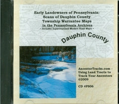
There are three sets of images on this CD:
(1) all 24 original Dauphin County Twp. Warrantee Maps on file in Harrisburg in .jpg format (no roads are shown on these maps)
(2) the 24 original Township Warrantee Maps in .pdf format
(3) all 24 Dauphin County Twp. Warrantee Maps over which modern road maps have been superimposed (both .jpg and .pdf formats).
Ancestor Tracks contracted with the Dauphin County Office of Information Technology to produce these geo-referenced maps for this CD so that descendants of the earliest landowners can pinpoint their ancestors' tracts on the current road system.
Each image can be zoomed in on to see names of current roads and the original settlers of the area. These Township Warrantee Maps are large documents averaging 3+ feet by 4+ feet (in contrast to the cropped and reduced-size versions published in the atlas), and some are as wide as 6 feet.
The full-size scans contained on this CD are thus very detailed. You can zoom in almost infinitely to view all details (including "W-O" and "B-O" for white and black oaks, respectively) on each map using your photo editor.
One of the most important references to be found on each tract shown on the maps is the Survey Book and page number. Nearly all individual surveys were copied into ledgers at the beginning of the 20th century, and they have been posted online by the Pennsylvania Archives.
2009, 48 pages, CD
No ISBN assigned
Price: $20.00
SKU: CD-598
Usually ships within1-3 days