Authors: Sharon C. and Angus MacInnes
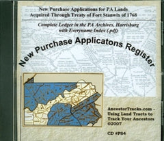
This CD includes applications for PA lands acquired through the Treaty of Fort Stanwix of 1768. 3 PDF Files: 1) 1770 PA Map by William Scull. (In 1770, soon after the New Purchase allowed expanded settlement within Pennsylvania, William Scull drafted a map of the colony. Scull was personally acquainted with much of Pennsylvania since he was one of the surveyors who platted land within the New Purchase. His map shows many of the topographical features which the applications use to describe the location of the requested tracts. This was the best map available of Pennsylvania at the time and is often referred to in official documents.) 2) Images of the Original New Purchase Application Register. Each page of the New Purchase Applications Register has 6 columns: date of application, number assigned in the lottery, name of applicant, number of acres applied for, description of location and where the survey was recorded (book and page number).
In addition to the official entries, handwritten marginal comments usually give current townships and counties. If the New Purchase applicant had transferred ownership of the tract to another person, the Name of Applicant shows to whom the warrant was returned and the date of the return. Under the Description of Location heading, the neighbors are usually given and sometimes fairly specific locations. 3) Every name Index to New Purchase Applications by Sharon C. and Angus MacInnes.
This is also a jpeg map of Indian Treaties and New Purchase 1768 map as well as instructions on how to use the New Purchase Register.
2007, 520 pages, CD
No ISBN assigned
Price: $20.00
SKU: CD-A-PS4
Usually ships within1-3 days